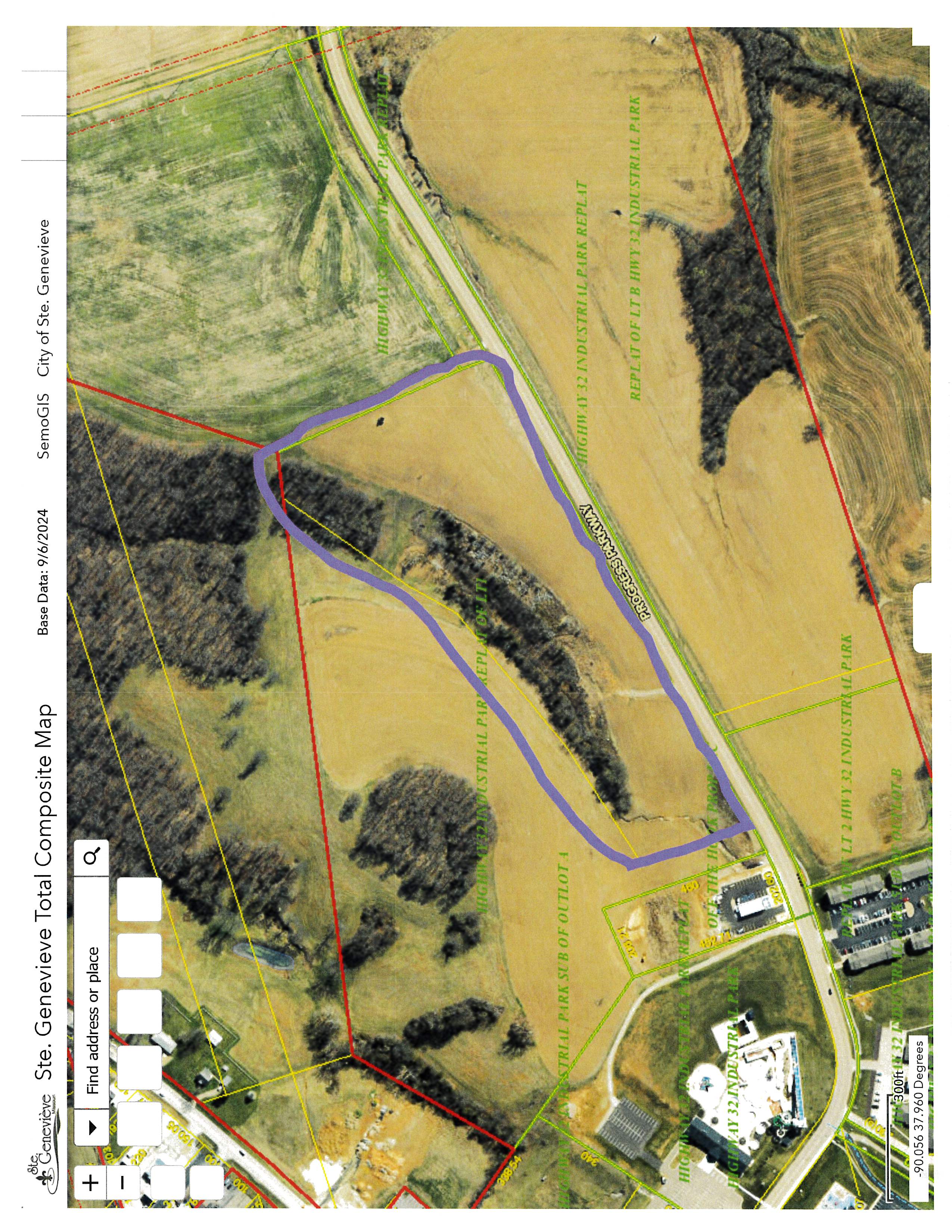
14 Acres Progress Parkway
DESCRIPTION
14 acres of undeveloped greenspace with road frontage on Progress Parkway. Approximately 11 acres developable.
PROXIMITY TO INTERSTATE
From exit 150 go east 5 miles to Progress Parkway, turn right and the property will be 2000 feet on the left hand side.
LONGITUDE AND LATITUDE
37.955191, -90.060398
SITE INFORMATION
§ Total Acreage: 14.29
§ Number of Acres Certified: n/a
§ Price per Acre or Lease Price of Certified Acres: $25,000
SITE DEVELOPMENT INFORMATION
LAND DETAILS
§ Prior Use: Agricultural
§ Current Use: Corn Crop
§ Adjacent Land Uses: Agricultural, Restaurant, Residential, Water Park
§ Environmental: Land has been used for farming
§ Structures: None
§ Zoning: General Commercial/
Residential
TYPOGRAPHY
§ Minimum Typographic Elevation: 520
§ Maximum Typographic Elevation: 560
§ Max Elevation Change: 20-26 ft.
§ Percent of Slope: 7%
§ Type of Growth/Foliage: grass/trees
UTILITIES
§ Water On-Site: yes
§ Water Provider and Contact: City of Ste. Genevieve
§ Water Capacity: 1.5m gpd
§ Wastewater On-Site: yes
§ Wastewater Provider and Contact: City of Ste. Genevieve
§ Wastewater Capacity: 750,000 gpd
§ Natural Gas On-Site: nearby
§ Natural Gas Provider and Contact: Spire
§ Natural Gas Capacity: unkown
§ Electricity On-Site: yes
§ Electric Provider and Contact: Citizens Electric Corporation
§ Electric Capacity: Adjoining lot has 12,470 volt 3 phase primary – upgrades negotiable
§ Broadband On-Site: unknown
§ Broadband Provider(s) and Contact: Charter/Spectrum
SITE ACCESSIBILITY
§ Number of Access Points: 2-Highway 32 and Highway M
§ Number of Roads w/ Access to Site: 1
§ Traffic Control: no
§ Other Manufacturing Facilities in Area: To the east is a leatherworks manufacturer, window plant, airplane parts, and others.
CLIMATOLOGICAL DATA
No severe weather issues have impacted the site.
TRANSPORTATION
§ Local FAA Approved Airport: St. Louis Lambert International Airport
§ Distance to Closest Regional Airport: 77 miles
§ Transit Time from Site to Airport: 1 hour 15 minutes
§ Regional Airline Service: Southwest and others
§ Closest Rail: UP & BNSF
§ Distance to Rail: 2 miles
§ Closest Port: New Bourbon Port Authority
§ Distance to Port: 4 miles
§ Closest Multilane Highway: I-55
§ Distance to Multilane Highway: 5 miles
§ Closest N/S Interstate: same
§ Distance to N/S Interstate: same
§ Closest E/W Interstate: I-44 to the west, I-64 to the east
§ Distance to E/W Interstate: 45 miles
POINT OF CONTACT
§ Contact Name: David Bova
§ Contact Address: 165 S. 4th St., Ste. Genevieve, MO 63670
§ Contact Number: 573-883-5400
§ Contact E-Mail: dbova@stegenevieve.gov